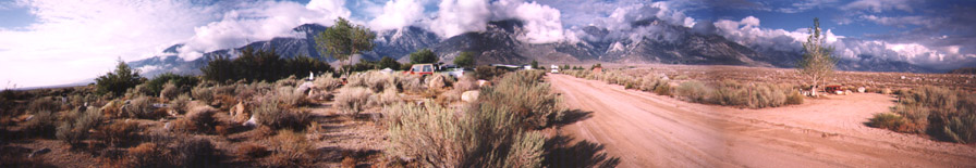
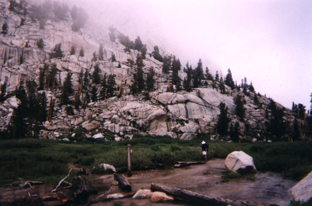
| Before the ascent up Whitney, we camped out here at Turtle Creek, a public camp area at the base of the mountain. Mt. Whitney is hidden in the back of these mountains. |
| DATE: | September 5 and 6, 1998 | WEATHER: | cold, rain, cloudy, hail | HIKERS: | Doug, Cecelia, Calvin, Sarah, Grant |
| Before the ascent up Whitney, we camped out here at Turtle Creek, a public camp area at the base of the mountain. Mt. Whitney is hidden in the back of these mountains. |
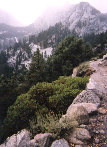 The weather is very unpredictable up there and can change in an instant. Things were ok here in the early part of the trail, but you can see the clouds hanging low in those mountains. Rain and cold, and later hail, eventually hit and made things pretty darn cold and miserable. We decided to turn around and try again the next day.
 This is the same trail the next day. The hike seemed totally different. Blue skies, just awesome. Make sure you listen to the weather report the day before you try and tackle this mountain.
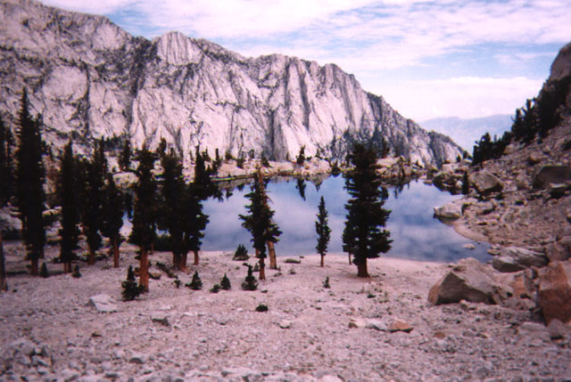 Lone Pine Lake, maybe 2 miles up. Nice place to take a break. You can also camp here if you like.
 After the Lone Pine Lake the surroundings changed to open pasture type of land, with a river running through it.
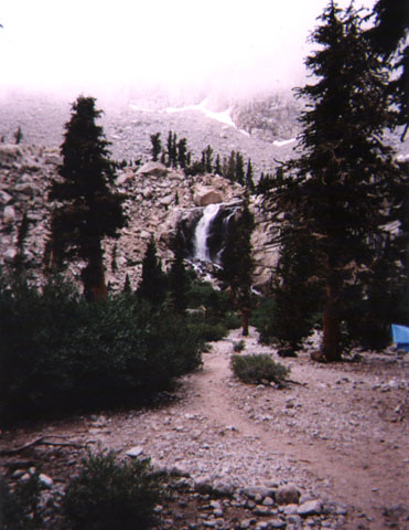 The first campsite, I believe it was called "Outpost Camp". It had this nice waterfall in the background. Watchout for bears in the area. Hang up that food.
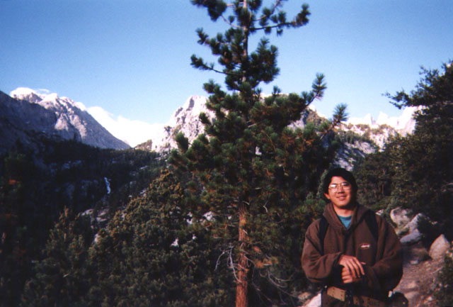
Little did I know, Mt. Whitney is the highest peak in the continental 48 states. I thought this was an easy going backpacking trip. Not some "kick my ass" K2 or Everest type. Calvin, me, and Sarah drove up Friday, met coworker Doug and his friend Cellule there and camped out at some public camp grounds at the base of the mountain. The plan was to drive to the trailhead and backpack all our stuff to a campsite half way up Whitney. Then sleep there, and finish the trek to the summit the next day with just day packs. Well, my 60+ pound pack weighed me down pretty good, and the rain and cold, and later hail, made us all pretty darn cold and miserable. We all turned around and had a nice pizza at a nearby town. Next day, we tried again, this time with just day packs and we were to go as far as we could in that one day (no sleep overs). It was a beautiful morning. The hike seemed totally different. Blue skies, you could see the mountain peaks, just awesome. My coworker Doug was intent on making the top, so he took off. The rest of us took it easy and absorbed the many different types of scenery. Nice waterfalls, jungly atmosphere, and then we reached the top of a mountain and it opened up into a beautiful lake called Lone Pine Lake. Going on, we saw different types of plants and flowers, open skies. Then it changed again to open pasture type of land, with a river running through it. Reached a campsite and ate Cup o Noodle lunch, no Zip packs =(. We continued on and then we saw clouds again, ohoh. At little past the 4 mile mark, it started raining, and we decided to turn around. Later that night, Doug returns. He made it to the top, and he met this dude going up to the summit. That guy came back with Doug and invited us all to his motel to relax in the jacuzzi. Woohoo!
NOTES:
Wt. Whitney is the second highest peak in the United States, the highest being Mt. McKinley in Alaska. The hike is a 22 mile round trip. You will need a permit if you want to camp along the trail, and permits go real fast. You may have to reserve a permit as far as 5 months ahead of time. The weather is brutal up there. According to a guy who does the hike regularly, the best time to do it is in early September.