| DATE: | February 7, 1998 | 
|
|
| WEATHER: | cool, very clear, excellent hiking conditions | ||
| HIKERS: | Alex Okihara, Wayne Shibata, Grant Tokumi |
| DATE: | February 7, 1998 |
|
|
| WEATHER: | cool, very clear, excellent hiking conditions | ||
| HIKERS: | Alex Okihara, Wayne Shibata, Grant Tokumi |
 The beginning portions of the hike takes you through this type of grassy field. If you look closely, you can see the FAA station at the top of the mountain in the background. That is the destination
 The Dupont hike starts from Waialua High School and ascends this ridge to the top of Mt. Kaala on the Waianae Range. This is overlooking the Waialua area.
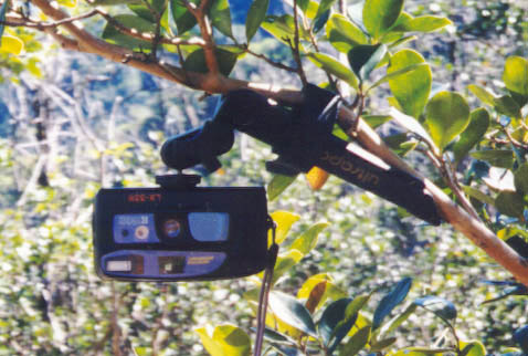 Now this is an ingenious design. Its a small tripod that Wayne ordered from a Campmore catalog. You can separate it into 3 short legs like a regular tripod, or it has couple velcro straps so you can strap it like this to a branch or whatevers. The legs are shaped like a tent peg, so you can even press it into the ground like a peg if you wanted to. The swivel head at the top can face the camera in almost any direction. Perfect for those self-timer photographs.
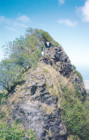 Some parts of the ridge were steep and fairly narrow. Cables were there to assist in those areas.
 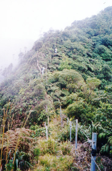 Its the Stairway to Ka'ala, but not steep like Haiku. These stairs led from a communication tower (on the trail) to the summit. The clouds started to roll in as we neared the top too.
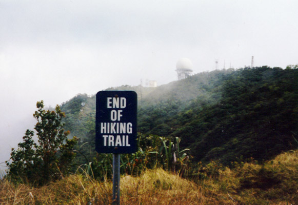 It say "End of Hiking Trail" but we know we have to go further. This is where the trail meets up with the road. The road is closed to public vehicles.
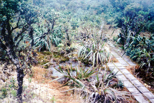 The nice bog at the top of Mt. Ka'ala. This wooden plank path was a nice touch. I felt like I was in a Japanese garden.
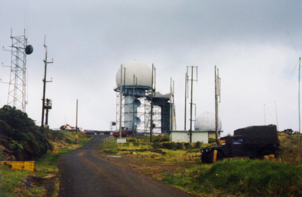 The FAA station at the summit.
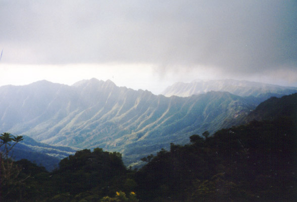 Going to the other side of Ka'ala, we got this nice view of the Waianae Range.
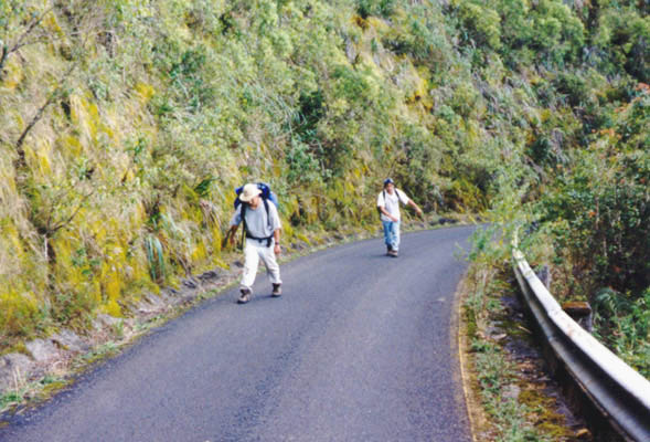 It looks like they are walking towards me, but they are actually walking backwards down the road. When walking downhill for 6 miles, you end up doing some strange hiking techniques. There were distance markers on the side of the road to remind us how much further we had to go.
|
The hike is 11 miles and involves a 4000 ft elevation gain (according to Stuart Ball's Hiking Bible). We saw all kind of animals. We saw cows, we saw what looked like a chicken run up the ridge, we saw pigs, we even saw a peacock. Nuts. And we saw darkness too. The hike started at 9:30, and took 7 hours to get to the summit of Mt Kaala but it shouldn't take that long. Vicious blackberry bushes were slashing my already scratched up legs (I had shorts). Once you reach the top, you can either backtrack on the trail, continue on the other side on the Mt. Ka'ala trail which takes you to the Waianae side, or you can hike down the road. We opted to take the road because we didn't have a car on the Waianae side and walking on a road in the dark seemed much better than backtracking on the trail in the dark. There were some stadium lights by Waialua High School so we used them as our guide. We were like moths attracted to those lights. Once we reached the bottom, we walked in the cane fields (or whatever kind of field that was) towards our car. 4 and a half hours later (from the summit), we finally reached our car. Yippie! It was now 9pm. I was exhausted. 11 and a half hours of hiking! Never again. Well, at least not for a day or two =) |
 Recommended book for hiking directions on Dupont |

Custom Search
|